Enjoy Cowley!
YOUR NEIGHBOURHOOD MAP
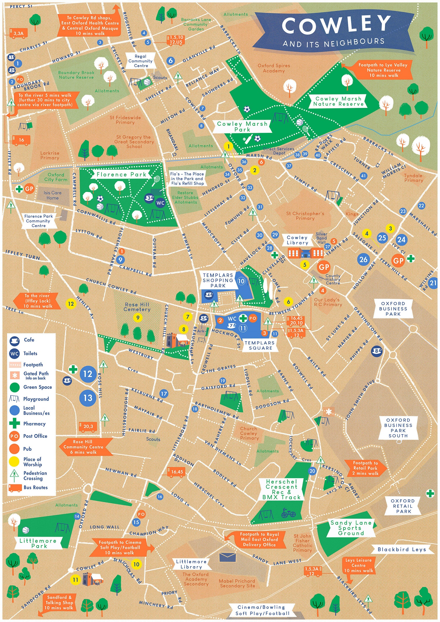
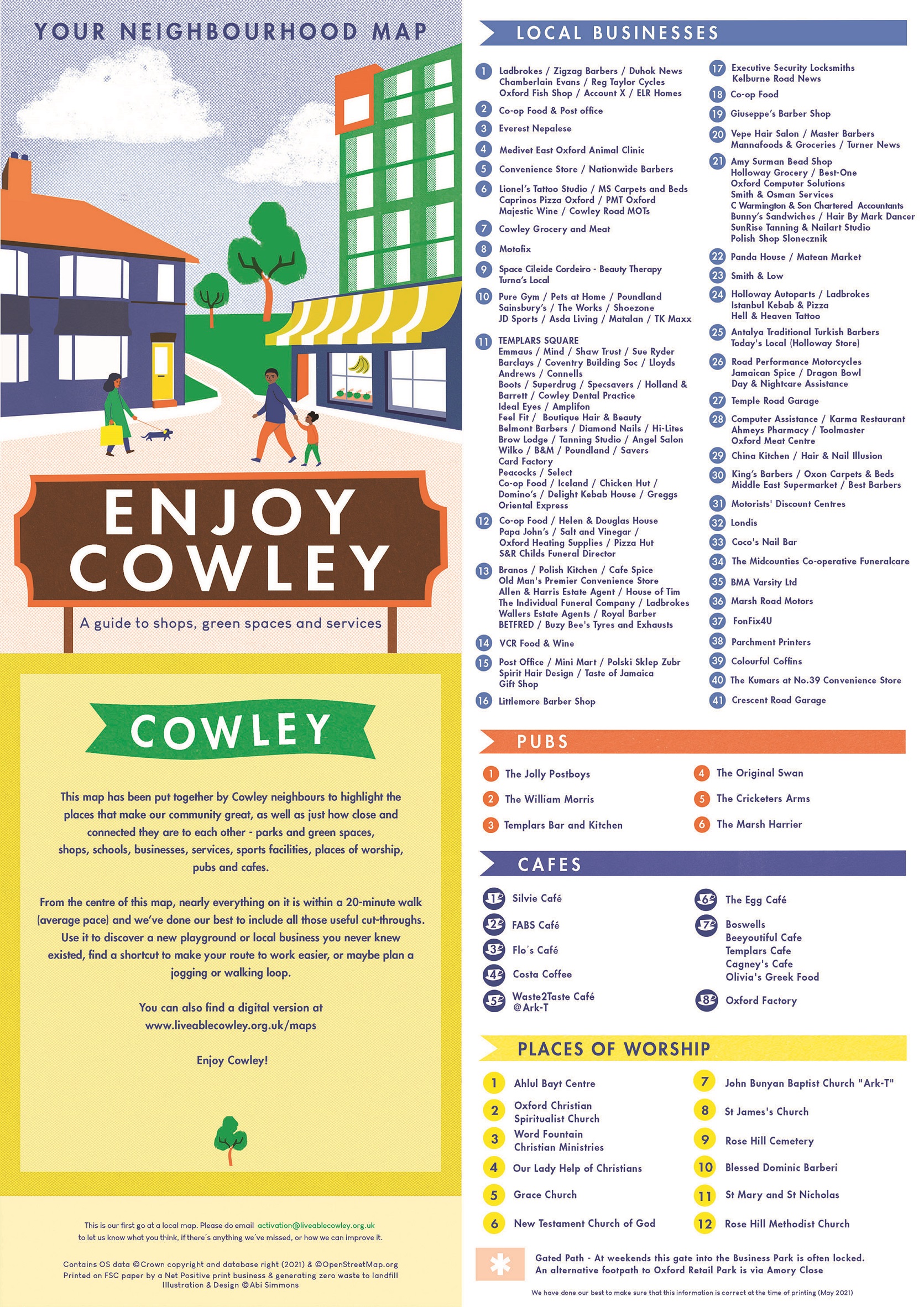
This map has been put together by Cowley neighbours to highlight the places that make our community great, as well as just how close and connected they are to each other — parks and green spaces, shops, schools, businesses, services, sports facilities, places of worship, pubs and cafes.
From the centre of this map, nearly everything is within a 20-minute walk (average pace) and we’ve done our best to include all those useful cut-throughs. Use it to discover a new playground or local business you never knew existed, find a shortcut to make your route to work easier, or maybe plan a jogging or walking loop.
Illustration and design by ©️Abi Simmons. Paper maps were printed by Seacourt, an Oxford-based company specialising in socially and environmentally conscious printing. The map was made possible by a grant from Active Oxfordshire.
This is our first go at a local map. Please email activation@liveablecowley.org.uk to let us know what you think, if there’s anything we’ve missed, or how we can improve it.
Enjoy Cowley!